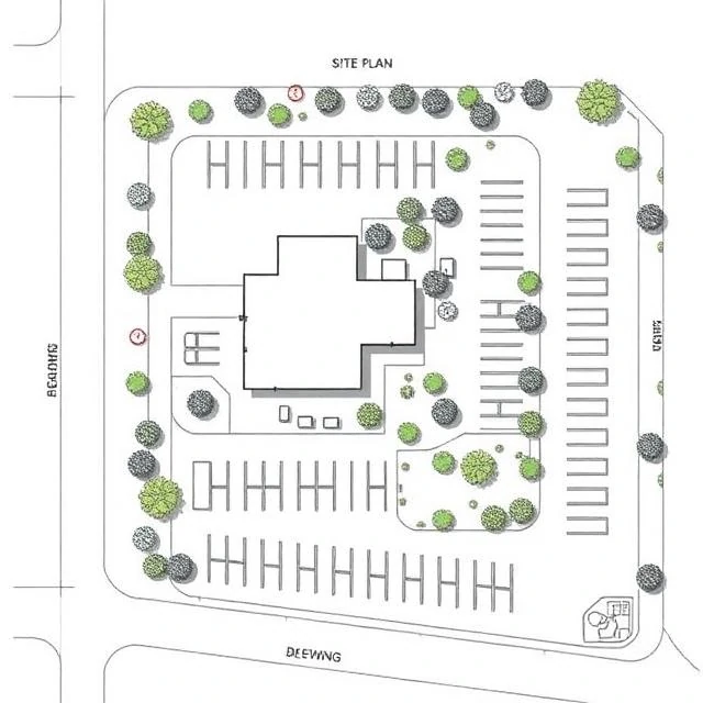
A site plan shows a building's position relative to its site boundaries. It is drawn from above, usually at a smaller scale than a floor plan, and includes property lines, setbacks, parking, driveways, sidewalks, landscaping, and utilities. It is the drawing that answers the question: where does the building go?
Site plans are used for zoning review, permitting, and construction. They show compliance with setback requirements, lot coverage limits, and parking minimums. They also show how the building relates to its neighbors, how sun and wind affect the site, and how people and vehicles move through it.
A good site plan does more than comply with regulations. It shapes the experience of arriving at the building. It directs views, controls access, and creates outdoor spaces. It also manages water, because stormwater runoff is a major issue on developed sites. Rain gardens, bioswales, and permeable paving are common strategies.
The site plan is where architecture meets landscape architecture, civil engineering, and urban planning. It is not just about the building. It is about the land around it.
Comments
No comments yet. Be the first to share a thought.
Leave a comment